Case study
La Pampa
State government
August 13, 2025

The Challenge
In the province of La Pampa, the Civil Defense Directorate is responsible for monitoring and coordinating the response to rural fires across a vast, diverse and highly vulnerable territory. With an area of 143,000 km², fires can start hundreds of kilometers from the capital and spread quickly through rural areas, private farmland and nature reserves. With limited resources (a staff of 5 to 15 people per shift), this created operational strain and critical delays.
Before Satellites on Fire (SoF), detection relied on a combination of:
Phone calls: They arrive without precise coordinates or context. Hard to know whether the fire is real, where it is and how to get there.
Traditional satellite imagery (NASA FIRMS): Alerts that arrive several hours or even days after the fire starts.
Manual field verification: Depends on staff experience and vehicle availability. High risk of error or delay.
No visibility into future fire spread: No tools to anticipate or decide how to act safely and effectively.

How Satellites on Fire Steps In
Since implementing SoF, La Pampa's Civil Defense has significantly improved its response capacity with:
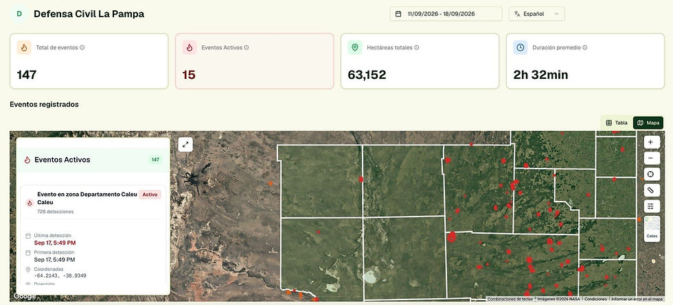
Satellite alerts within minutes: SoF detects fires with AI by combining satellites, lightning and cameras. Alerts arrive by WhatsApp and email in under 10 minutes.
Remote verification: The platform makes it possible to assess whether a reported hotspot is a controlled burn, an active fire or a false positive.
Spread tracking: When a fire is confirmed, SoF projects its estimated spread based on weather, terrain and vegetation, helping decide whether to scale up the response.
Visual history and traceability: Past events can be reviewed, backing decisions before other areas of government.
Full coverage: Unlike towers or camera systems, SoF covers the entire provincial territory, including areas with no infrastructure.

Main benefits
Faster detection:
Satellites on Fire gives them a one-hour head start over NASA FIRMS, allowing hotspots to be verified before they spread.
Continuous coverage:
They used to depend on shifts and schedules; now they have 24/7 surveillance, even in areas without infrastructure, improving response capacity at night and on weekends.
Spread simulation:
The platform projects how a fire may move based on weather and vegetation type, which improves planning and resource use.
Operational alerts by WhatsApp and email:
Alerts show the exact location and the AI-estimated probability of a real fire, and fit quickly into the organization's response protocols.
Real impact
Thanks to SoF, verification times are coming down, brigades are being prioritized better and false alarms are decreasing. The team can now also act proactively, monitoring high-risk areas even before outside reports come in.
What's next
La Pampa has expressed interest in features such as:
Georeferencing on-duty personnel
Linking lightning strikes to detected hotspots to infer causes
Automating reports for political and budget presentations
This case shows how a technology solution designed to scale across a large territory can have a direct, measurable, everyday impact on the decisions of those on the front line of the emergency.

How They Use the System
The Civil Defense duty team receives SoF alerts by WhatsApp and email, with exact coordinates and the probability of a real fire. Phone reports are checked against the platform.
They verify remotely whether it is a controlled burn, an active fire or a false positive, before sending a vehicle.
If the hotspot is confirmed, they use the spread projection to decide whether to scale up the response and which brigades to dispatch.
“It helps us quickly understand whether it's a controlled burn or something more dangerous”
“It gives us satellite information we don't get from NASA FIRMS, and it reaches us sooner.”
“It's a good tool for justifying resources to the ministries”
“When there's a report, we use it to see how credible it is”